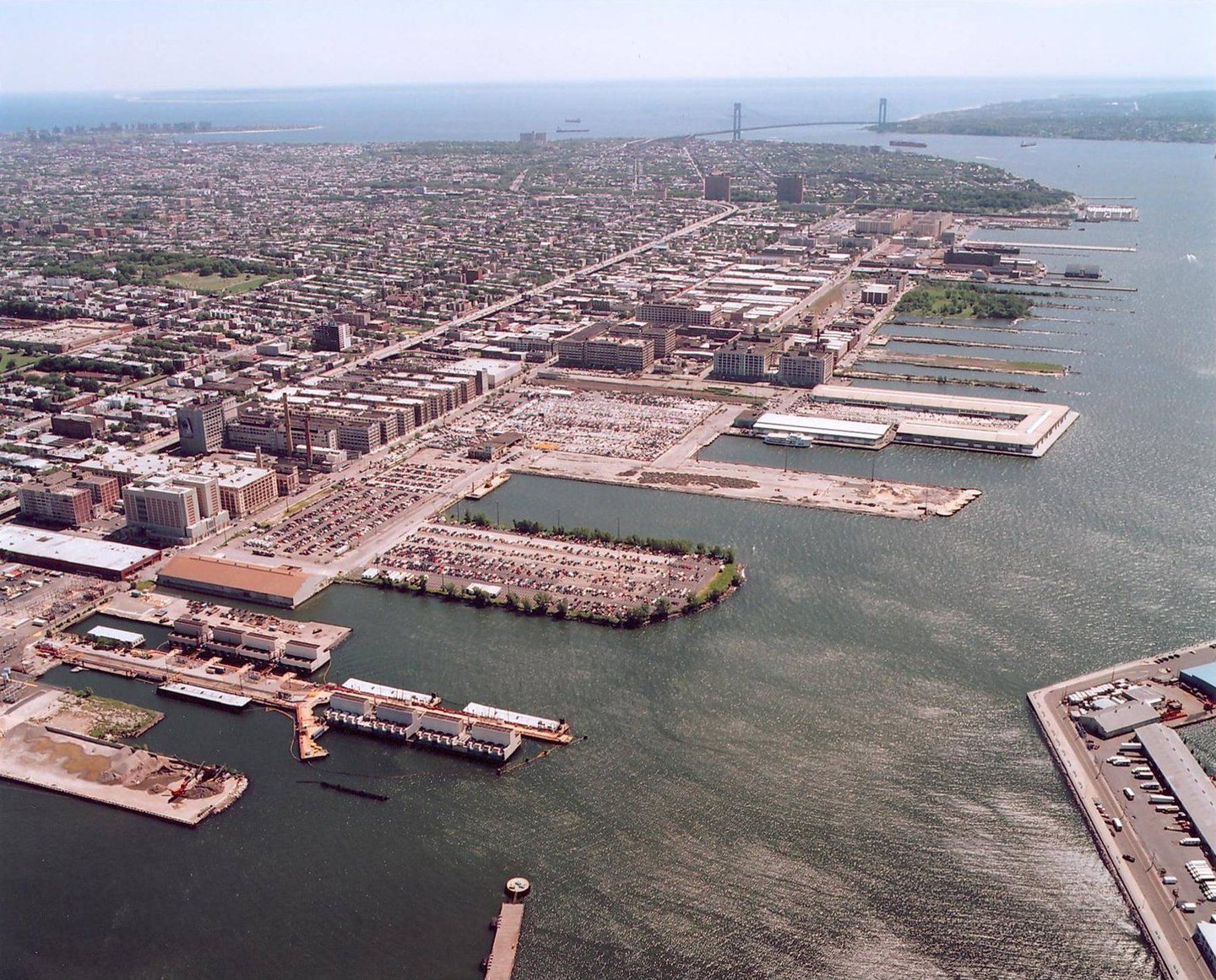
Aerial view of the Sunset Park Brownfield Opportunity Area.
Reclaiming brownfields for public benefit, the Sunset Park BOA Study charts a future where green industry, economic opportunity, and environmental justice intersect and thrive.
Sunset Park, shaped by heavy industry and crisscrossed by major infrastructure, has long carried the weight of its industrial past. Decades of underinvestment left behind more than 120 brownfield sites across the district, concentrated between the East River and Second Avenue, stifling the area’s economic potential with environmental hazards, outdated land use, and limited access to the waterfront.
The future for community members and businesses was shaped by pollution and disconnection, rather than growth. For change to take root, the plan needed to account for legacy contaminations, the need for sustainable industry, and civic infrastructure for the surrounding neighborhoods.
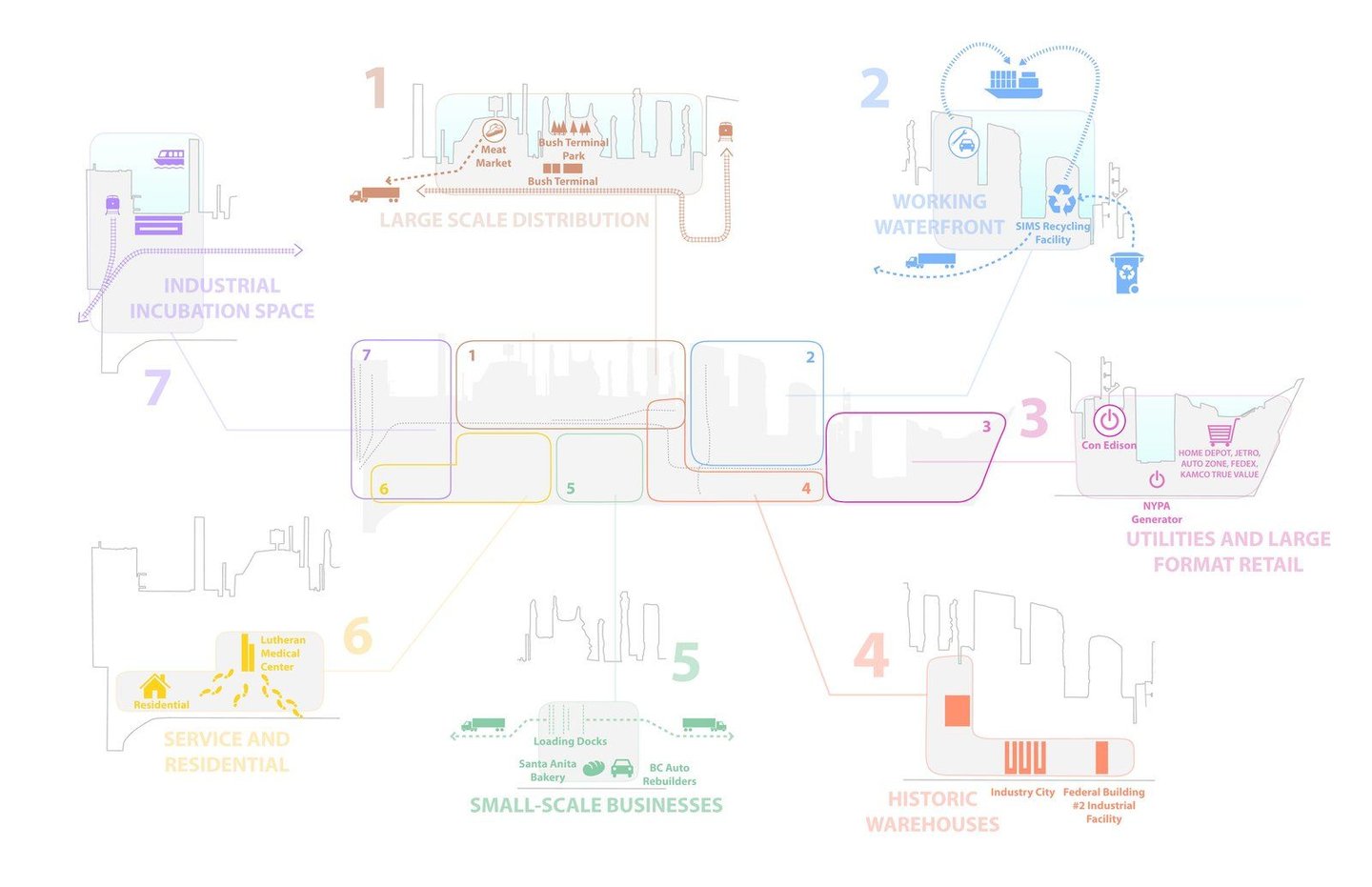
Functional zoning diagram of Sunset Park highlights areas for industry, retail, and residential services.
Led by WXY in partnership with UPROSE and other key collaborators, the Sunset Park BOA Study identified sites capable of unlocking green industrial growth while reconnecting people to the waterfront. The plan mapped public and private assets across 694 acres, emphasizing adaptive reuse, environmental remediation, and new green infrastructure. We evaluated each site strategically, focusing on economic return and the potential of service for the community, whether through job creation, sustainable development, or increased open space, reimagining industrial zones as part of a broader ecological and civic network.
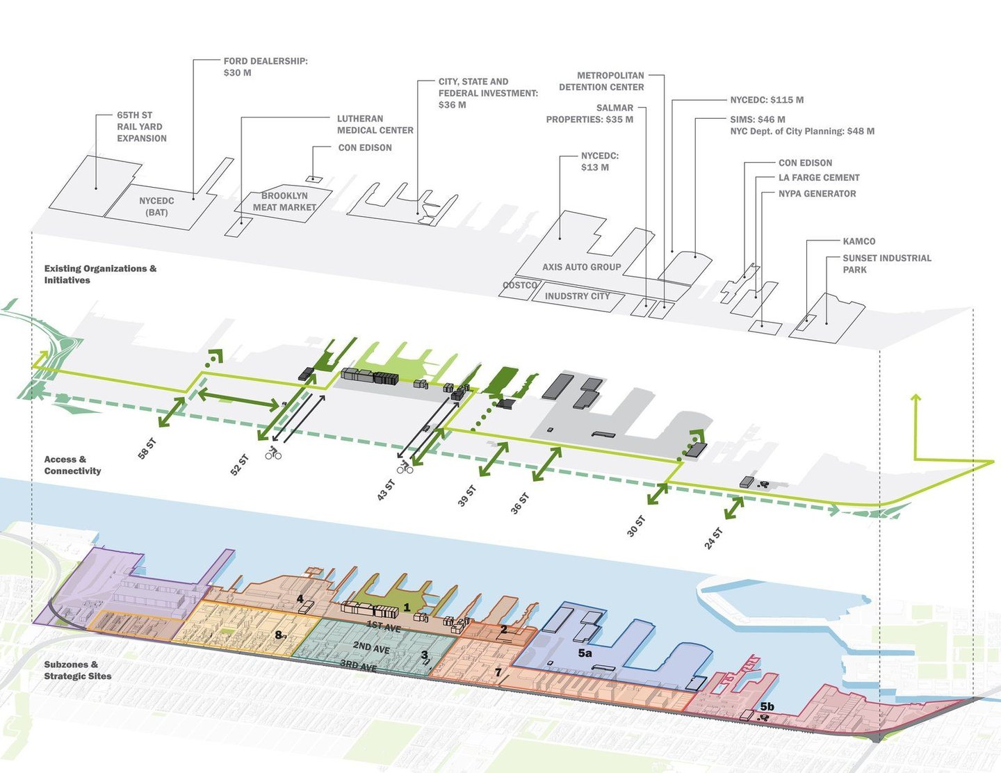
Rendering of the strategic framework for Sunset Park outlines key sites, access routes, and organizational investments.
From the outset, the planning process gave Sunset Park residents a direct role in defining the neighborhood’s future. Visioning sessions, public meetings, and ongoing conversations made space for local priorities like cleaner air, access to good jobs, and stronger ties to the waterfront. Community knowledge was paired with technical insight from HR&A, Gannett Fleming, and the Southwest Brooklyn Industrial Development Corporation, whose contributions helped translate ideas into a phased, implementable framework.
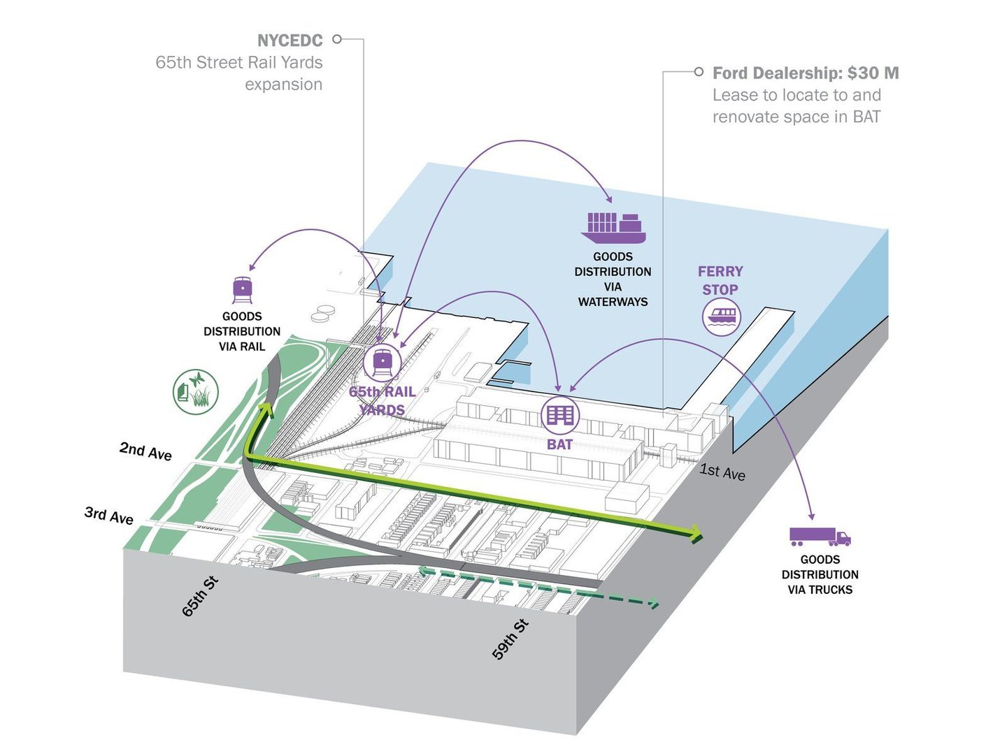
Multi-modal distribution plan for Sunset Park integrates rail, waterways, and trucking routes.
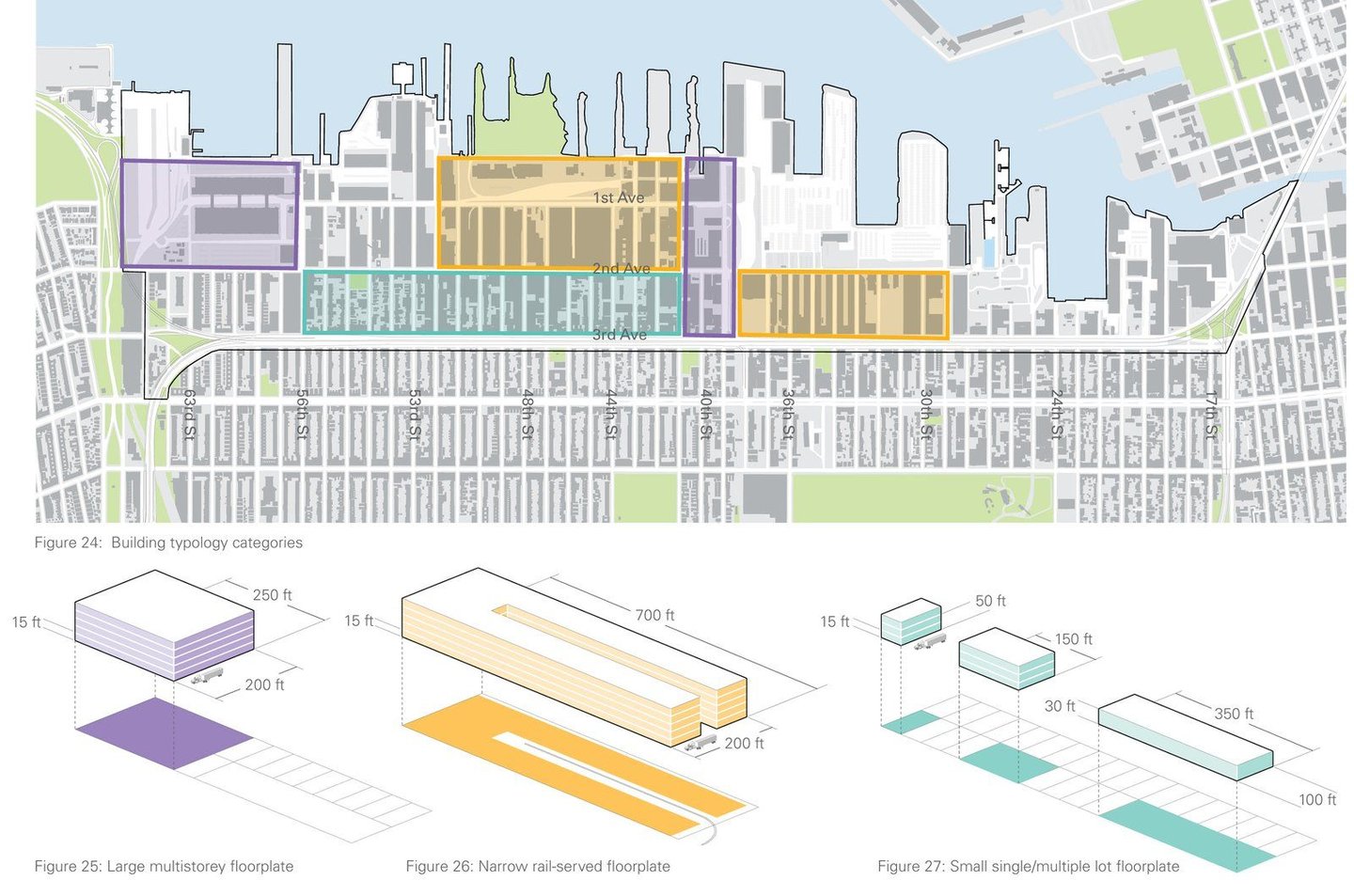
Building typology map categorizes Sunset Park structures, illustrating diverse floorplate designs.
The Sunset Park BOA set in motion lasting change. Since 2009, nearly $620 million in public investment has flowed into the neighborhood. The Brooklyn Army Terminal now supports over 100 tenants and more than 4,000 jobs, while Equinor is transforming the South Brooklyn Marine Terminal into one of the country’s largest offshore wind hubs. Across the district, green infrastructure and public space improvements continue to link environmental goals with economic opportunities.
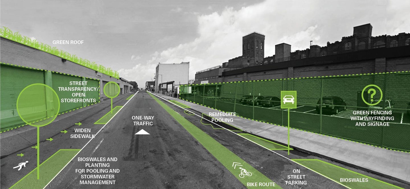
Rendering of streetscape enhancements that manage stormwater , pedestrian access, and green infrastructure.
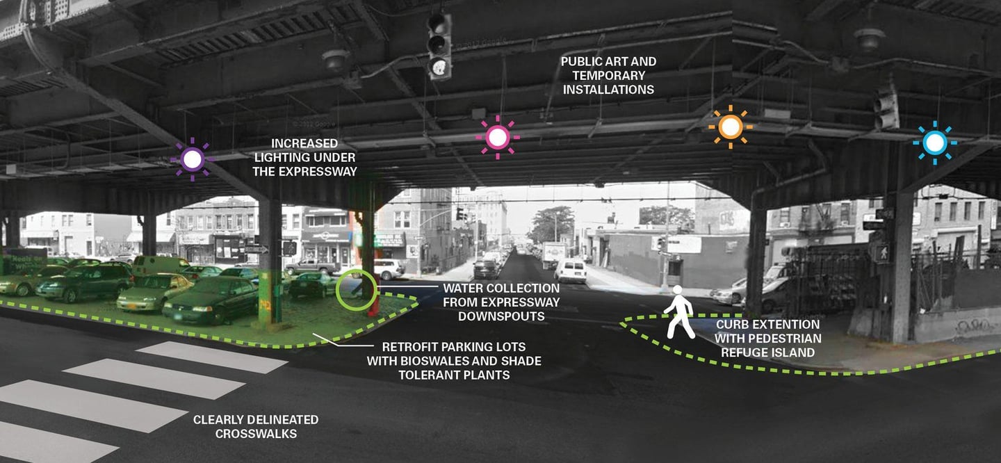
Enhanced BQE underpass design integrates lighting, public art, and bioswales to improve safety and aesthetics.
Claire Weisz Architects LLP
d/b/a WXY architecture + urban design
212 219 1953
office@wxystudio.com
Careers ↗
New York
25 Park Place, 5th Floor
New York, NY 10007
Toronto
30 St. Patrick Street, 5th Floor
Toronto, ON M5T 3A3 Canada
Subscribe to our newsletter
Site designed by Clinton Van Arnam
Developed by Mario Giampieri