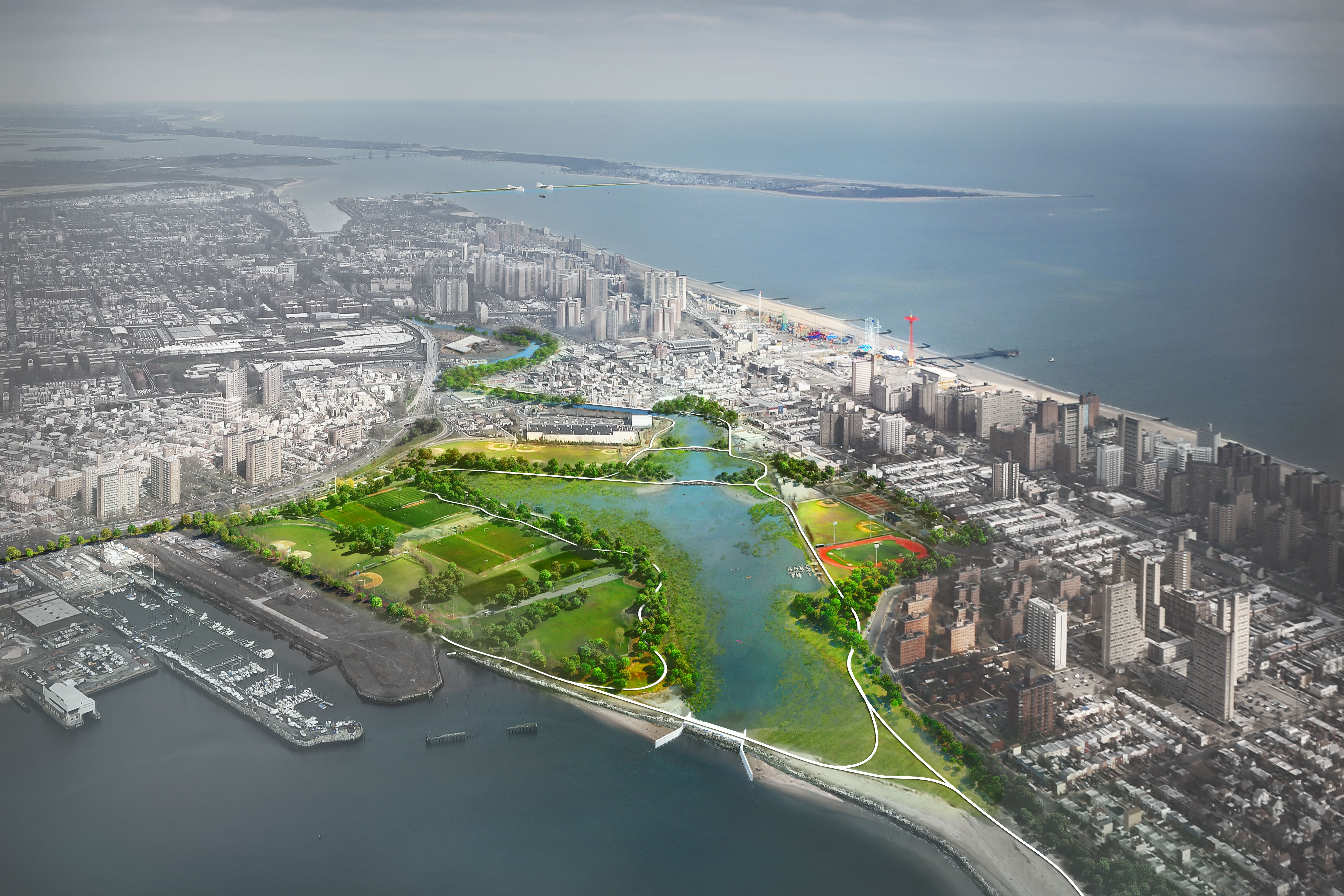
Aerial of Coney
GIS analysis and community planning came together to map where investments could strengthen the Brooklyn-Queens Waterfront, guiding resiliency upgrades that support small businesses, aging infrastructure, and some of the city’s most flood-prone neighborhoods.
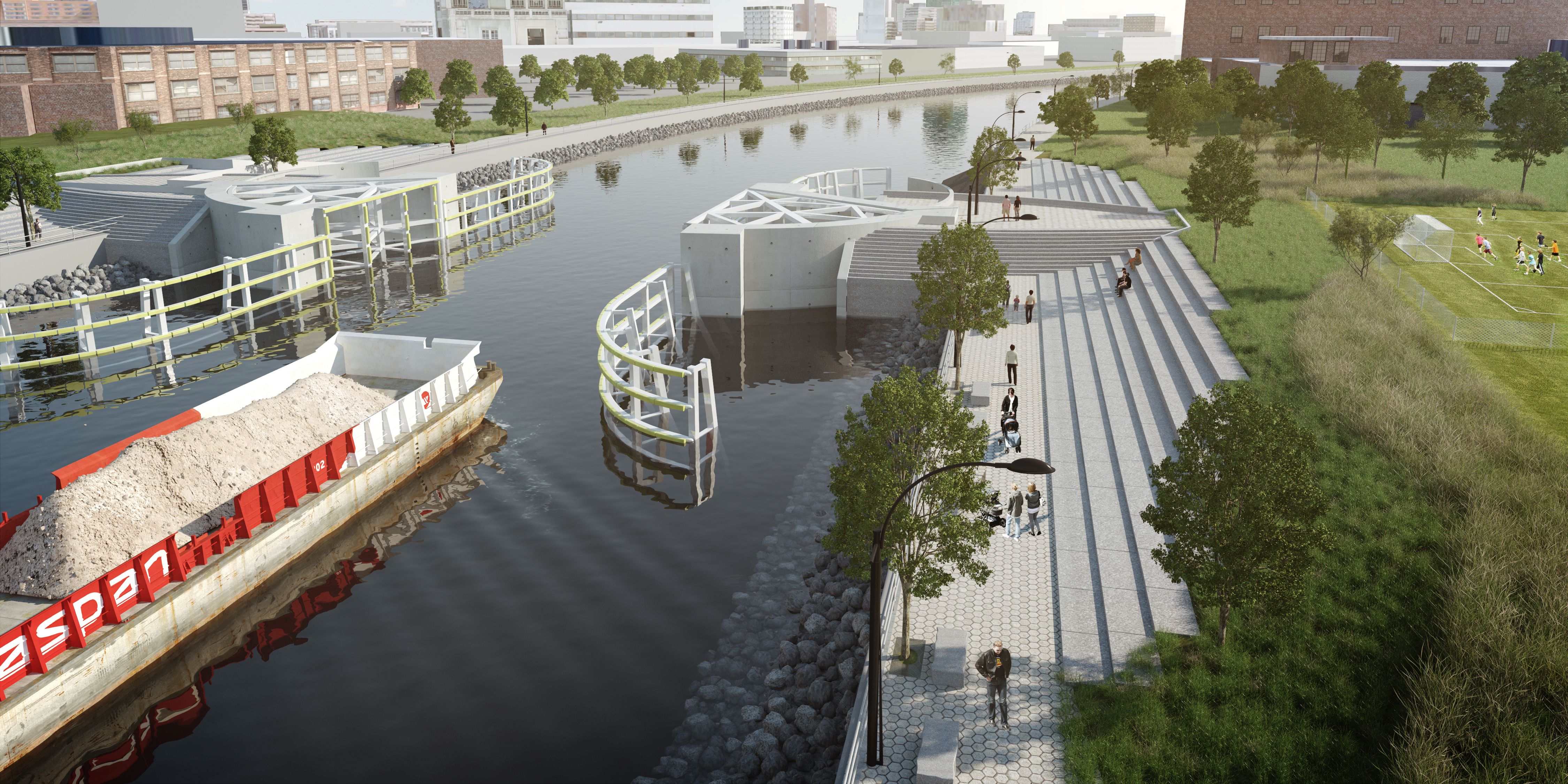
Planning recommendations, embedded in GIS analysis and costed design of retrofit and resiliency measures, for the Brooklyn-Queens Waterfront dealt with a range of coastal protections and strategies for buildings, infrastructure and community development. Red Hook and Newtown Creek were two areas of particular focus for their high vulnerability to flooding today and into the future with rising tides.
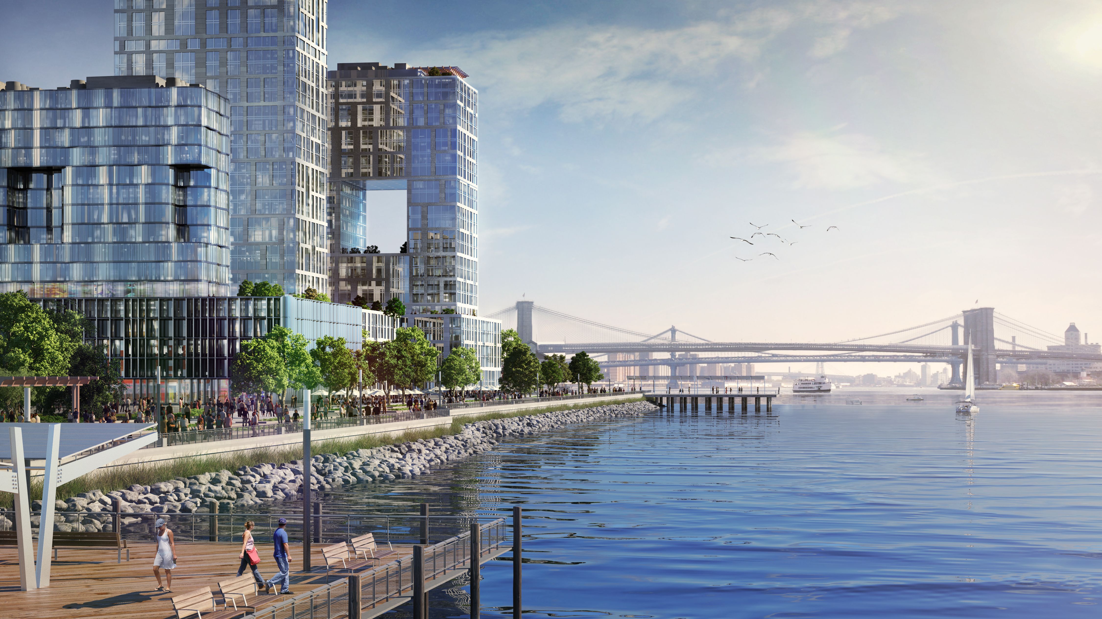
Rendering of East River City
Mayor Bloomberg launched the Special Initiative for Rebuilding and Resiliency (SIRR) to develop the City’s plan for rebuilding neighborhoods hardest hit by Superstorm Sandy and to adapt the building stock and infrastructure towards greater resiliency for the risks posed by climate change. For the Brooklyn-Queens Waterfront, where WXY was the City’s lead community planner, the vulnerabilities of industrial neighborhoods needed to be assessed according to the particularities of predominantly older, low-rise building stock and independent business owners.
Claire Weisz Architects LLP
d/b/a WXY architecture + urban design
212 219 1953
office@wxystudio.com
Careers ↗
New York
25 Park Place, 5th Floor
New York, NY 10007
Toronto
30 St. Patrick Street, 5th Floor
Toronto, ON M5T 3A3 Canada
Subscribe to our newsletter
Site designed by Clinton Van Arnam
Developed by Mario Giampieri