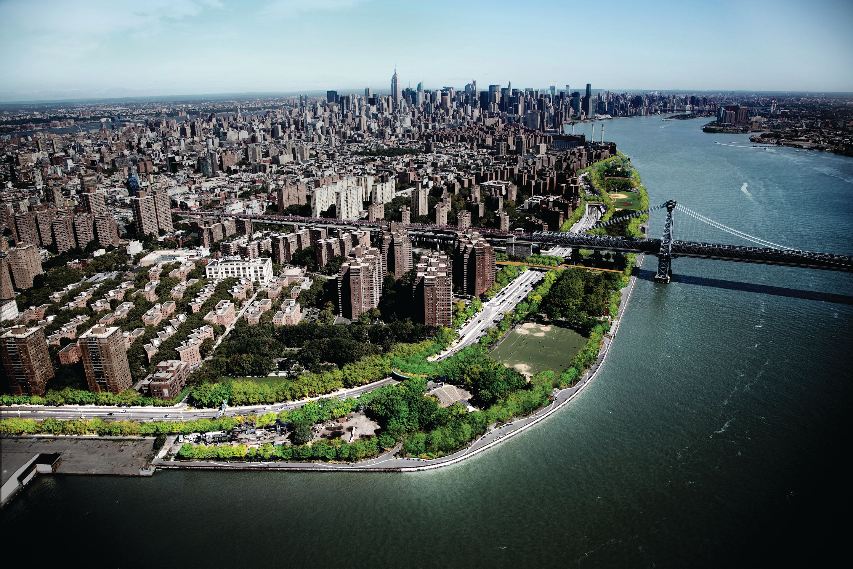
Aerial rendering of Blueway
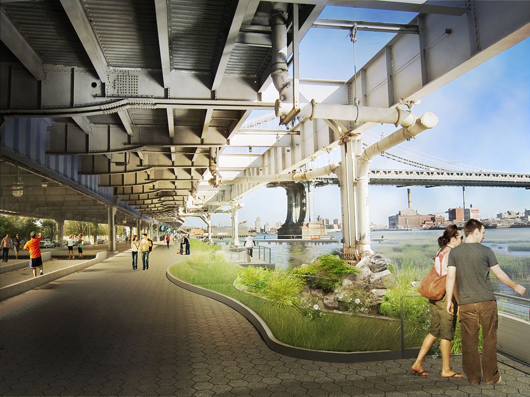
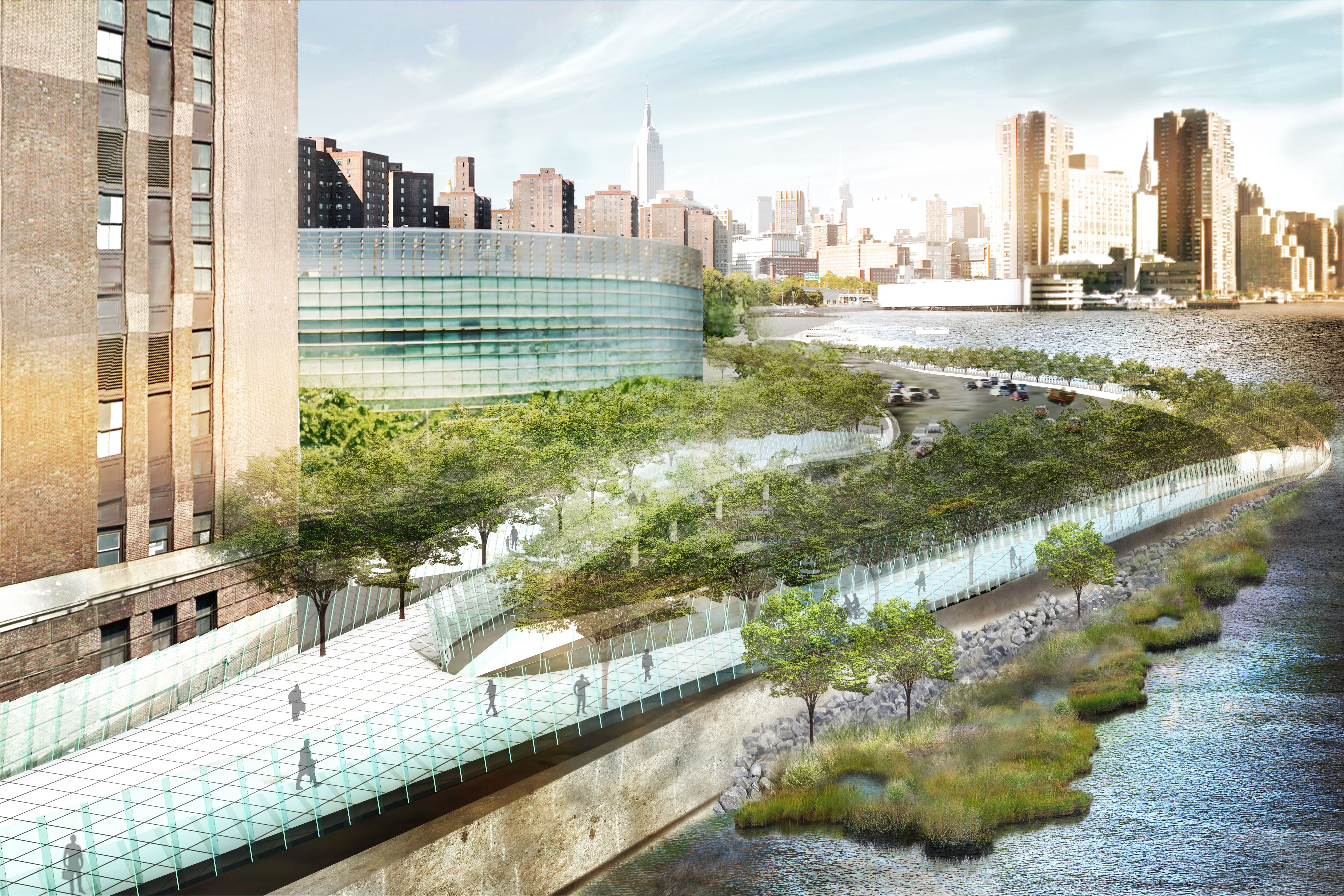
Instead of hardening the shoreline against the river, the plan introduces wetlands, pathways, and public space to absorb storm surges, support biodiversity, and reconnect neighborhoods with the waterfront.
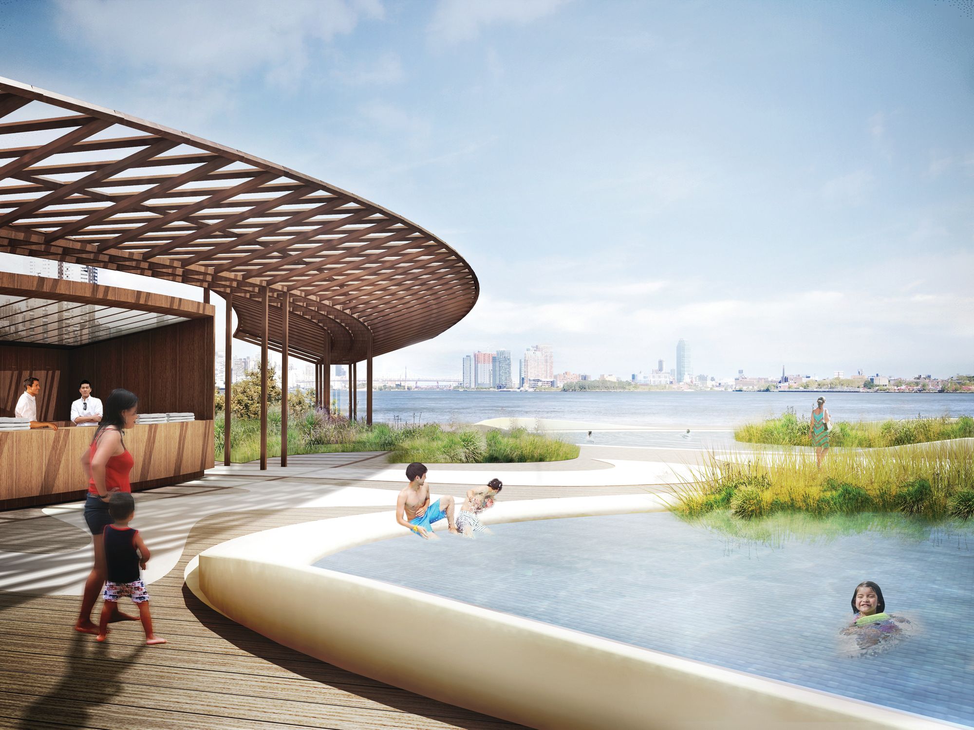
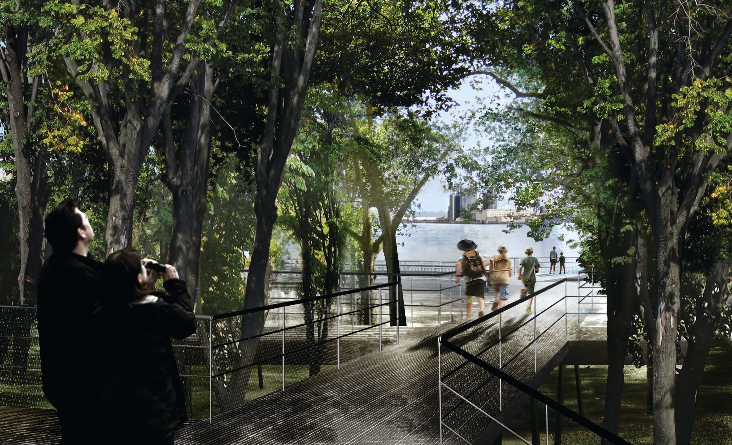
The plan identified and designed key points and down-to-the-water sites to engage with the East River from the water and from the shore, and proposed improvements to a series of access routes linking East Side communities to the redesigned East River waterfront.
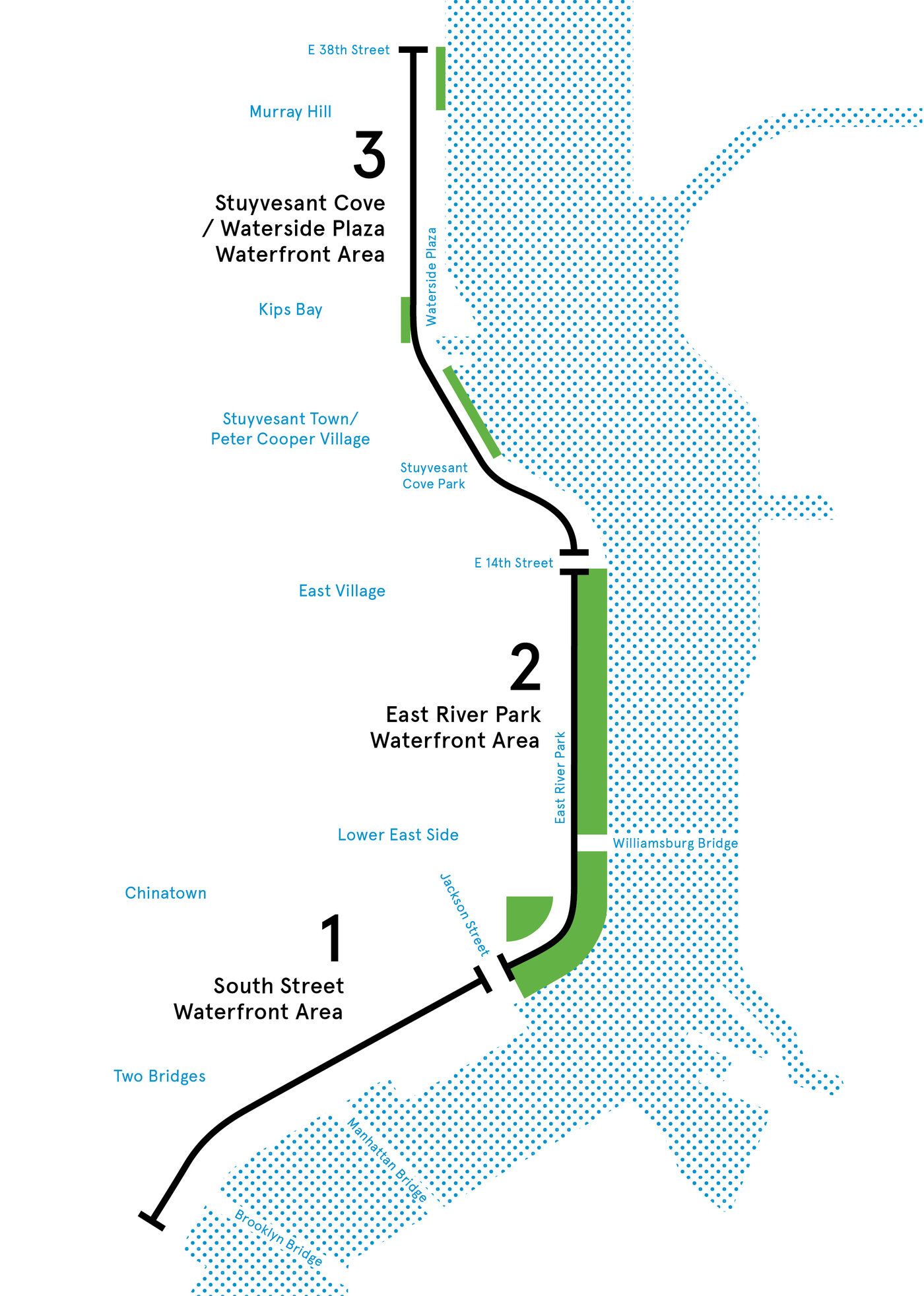
The East River Blueway Plan is a community-based waterfront initiative that establishes a planning and urban design framework for Manhattan’s East River waterfront, from the Brooklyn Bridge to East 38th Street. This study aims to establish a unified and sustainable vision for a stretch of waterfront with the potential to provide new recreational and educational opportunities, while improving storm resiliency.
Rendering by WXY
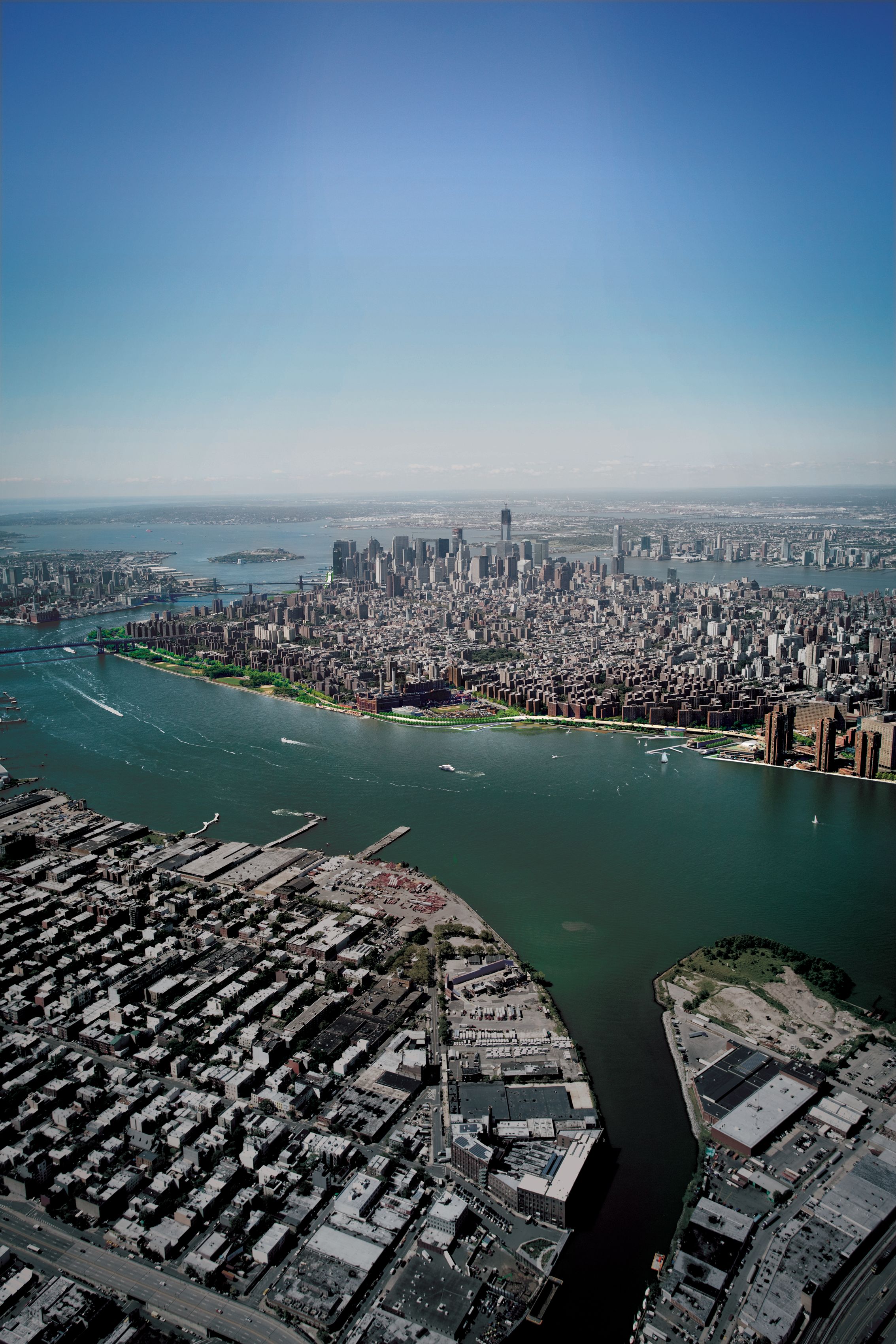
The plan created a long-term, sustainable vision that takes into account climate change, stormwater management, technological developments, and evolving transportation trends. It also established a network of waterfront sites connected by continuous bikeways and waterfront esplanades with improved access to public transportation.
The local community played a central role in shaping the vision. The Plan represents more than a year of public consultations with suggestions and feedback gathered from dozens of stakeholder meetings, several public workshops, surveys, and an interactive website.
Rendering by WXY
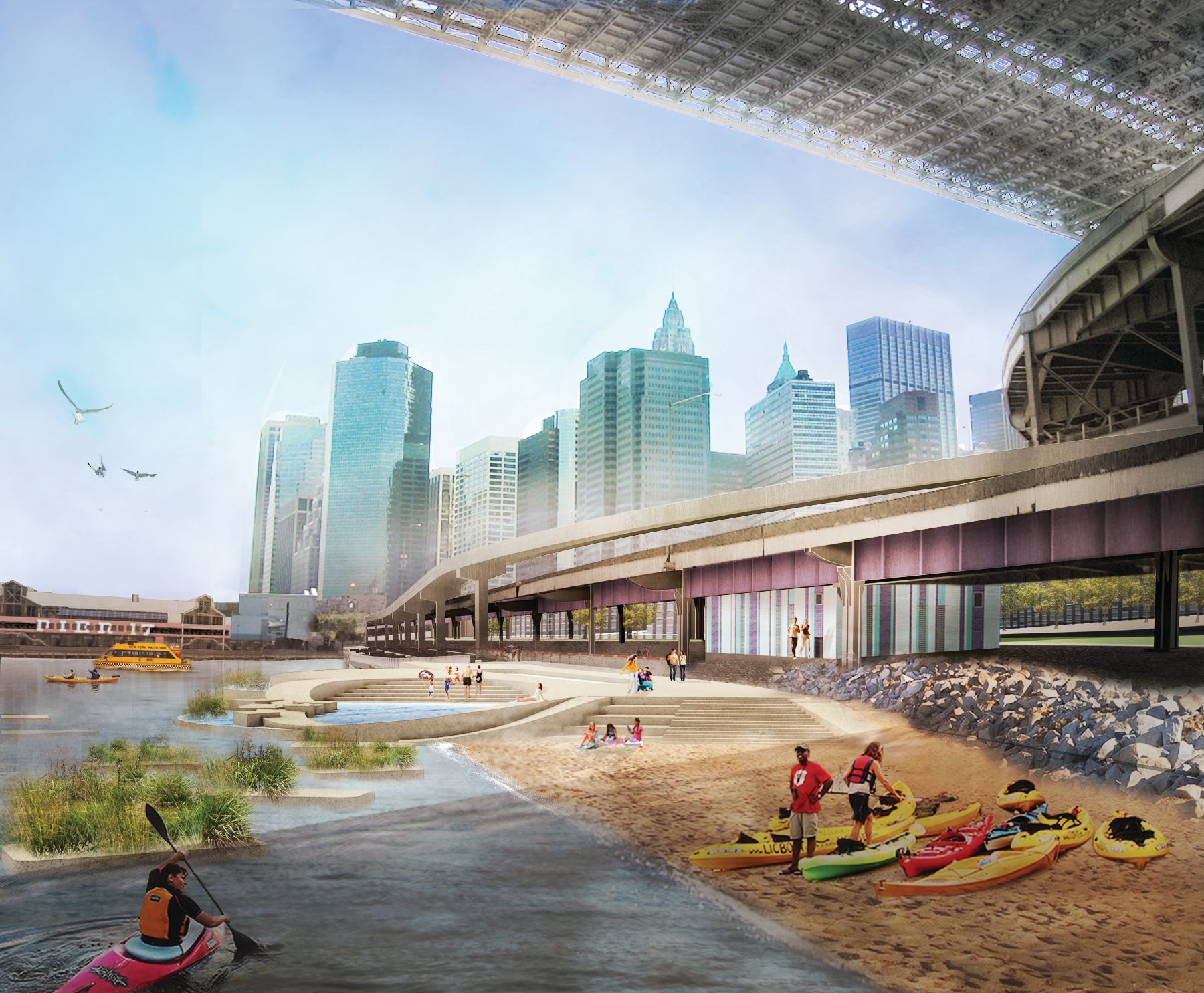
The Blueway Plan responds to the challenges of extreme weather events and gradual sea level rise. The unprecedented impact of Hurricane Sandy has reinforced the need to strengthen and protect our shoreline, critical infrastructure, and neighborhoods. The East River Blueway Plan is a model for resiliency as it provides a vision of an accessible and dynamic waterfront that also addresses the urgency of climate change and its effects.
Rendering by WXY
The study, funded by the New York State Department’s Division of Coastal Resources, was commissioned by Manhattan Borough President Scott M. Stringer and New York State Assembly member Brian Kavanagh, in collaboration with Manhattan Community Board 3, Manhattan Community Board 6, and the Lower East Side Ecology Center.
Claire Weisz Architects LLP
d/b/a WXY architecture + urban design
212 219 1953
office@wxystudio.com
Careers ↗
New York
25 Park Place, 5th Floor
New York, NY 10007
Toronto
30 St. Patrick Street, 5th Floor
Toronto, ON M5T 3A3 Canada
Subscribe to our newsletter
Site designed by Clinton Van Arnam
Developed by Mario Giampieri