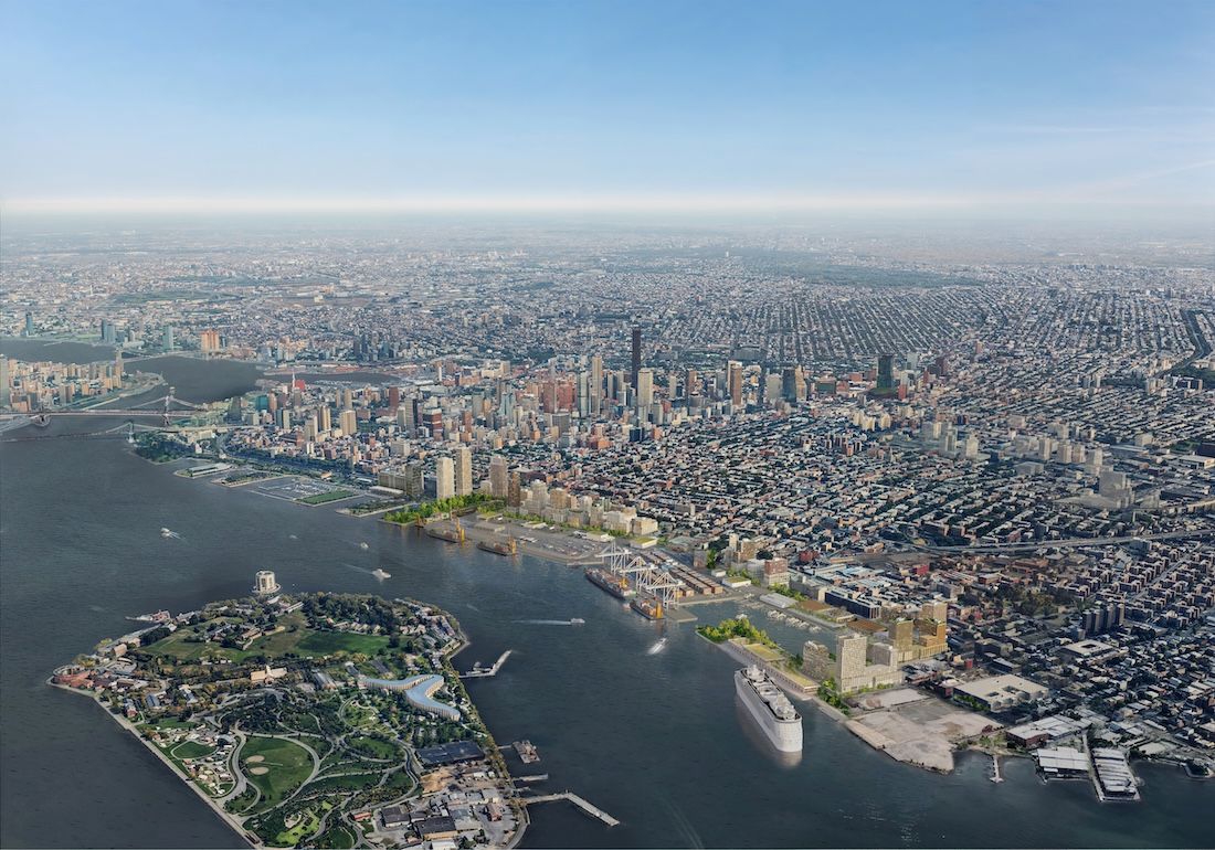
Crown Heights Neighborhood, in Atlantic Avenue Mixed-Use: Community Vision & Priorities Report, by New York City Department of City Planning (New York: NYC Planning, 2023).
A new year invites fresh thinking, but in a city as layered as New York, progress comes from ideas tested over time. The most effective innovation builds upon decades of complex planning, long relationships, and the ability to move seamlessly from policy to implementation.
1. Plan corridors, not just neighborhoods
Neighborhood planning captures local voices. Corridor planning gives them reach.
New York needs housing at a scale no single neighborhood can absorb alone. Planning at the corridor level allows growth to be distributed across connected areas while linking new homes to transit access, safer streets, and public space improvements. It reflects how people actually live and move through the city, rather than treating neighborhoods as isolated units.
 Engagement session for the Atlantic Avenue Mixed-Use: Community Vision & Priorities Report.
What it delivers
The Atlantic Avenue Mixed-Use Plan brought together residents from Crown Heights, Prospect Heights, Bed-Stuy, Clinton Hill, and Fort Greene to create a 21-block framework that will deliver 4,600 new homes, including 1,440 permanently affordable units, alongside 2,800 permanent jobs. This approach was codified into New York City’s official community planning framework in 2025.
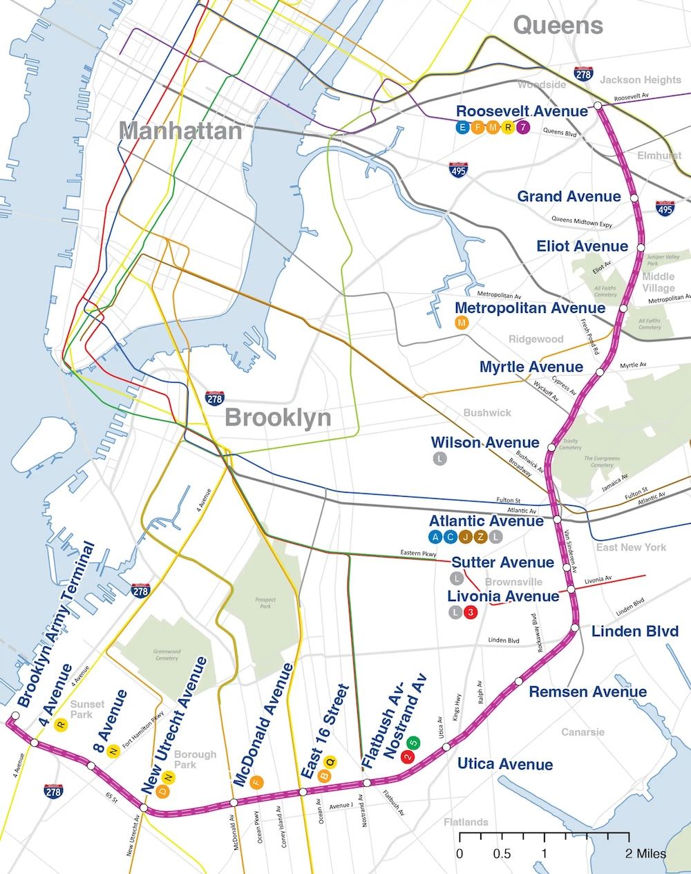
That framework reflects a broader shift toward planning corridors as shared systems rather than isolated rezoning sites. WXY is applying this thinking in its ongoing work with the New York City Department of Transportation and surrounding communities along the Conduit Corridor in Brooklyn and Queens.
The three-mile, Robert Moses–era arterial connects East New York to Aqueduct Racetrack and JFK Airport, yet has long functioned as a barrier rather than a civic asset. In partnership with TY Lin, the work focuses on rebalancing the corridor by improving pedestrian safety, rethinking underutilized medians, extending the greenway network, and identifying opportunities for housing and community amenities on and along the entire corridor.
Corridor planning makes tradeoffs visible and strengthens shared systems. By working across transit lines, retail corridors, and street networks, it spreads housing and investment more equitably and creates cohesive improvements that benefit every neighborhood along the way.
2. Plan at multiple scales, simultaneously
New York's affordable housing has overwhelmingly come from large developments. Research from the Furman Center shows that nearly two-thirds of income-restricted units are built in projects with 100 or more units. These large sites remain essential for delivering housing at scale.
But the planning system needs to make room for smaller interventions. These tools can enable homeowners and small developers to add housing incrementally, without dramatic changes to neighborhood character.
 Illustrative rendering of an Ancillary Dwelling Unit by WXY.
What’s possible
New York City’s ADU For You Program will allow homeowners to add an ancillary dwelling unit (ADU), also known as an accessory dwelling unit, using pre-approved designs and a digital eligibility platform developed by WXY. ADUs provide a flexible and affordable way to increase housing while maintaining neighborhood character, providing a means to generate income, and enabling aging in place. They serve as an efficient complement to larger projects, which can deliver more units but often require longer timelines.
Our work with NYCHA identified approximately 2.6 million square feet of development rights that could be transferred as of right to adjacent blocks, pairing new housing with community uses and activating underused land without requiring large-scale assemblage. That same logic underpins transit-oriented development strategies that align housing, jobs, and public space around major infrastructure.
 Rendering for the Herkimer-Williams development in East New York, Brooklyn, designed by WXY and developed by Totem.
In East New York, the realization of the Herkimer-Williams project builds on years of thoughtful planning and rezoning groundwork, including our Broadway Junction Planning Initiative. The four-building complex being developed by Totem will deliver nearly 1,000 affordable homes directly adjacent to one of the city’s most important transit hubs. The project also includes substantial commercial, retail, industrial, community facility space, and publicly accessible open space.
Progress depends on working at multiple scales. Large developments anchored to transit deliver housing volume and opportunity. Smaller tools, like development rights transfers, add flexibility and speed. Together, they create pathways to housing and investment in places where access, infrastructure, and planning already intersect.
3. Adapt Industrial Business Zones
Industrial Business Zones (IBZ) were created to protect jobs. Over time, many have become disconnected from the neighborhoods around them.
Residential development has not been permitted within IBZ boundaries, with zoning changes focused on commercial and industrial capacity, while housing growth has largely occurred at the edges of these districts or in nearby manufacturing areas outside formal IBZ designations. As a result, monofunctional zoning has often isolated IBZs from daily life, limiting both industrial potential, livability, and housing development. Workers must commute to job sites, adjacent residential areas often lack services and amenities, and districts that could support modern manufacturing, logistics, and housing, if planned thoughtfully, struggle to serve either industry or community well.
What reform looks like
In Long Island City, the One LIC framework explored a more flexible model for IBZs. Developed through close collaboration with the community and the city, it preserves job-generating space while allowing residential and commercial uses that help the district function as a complete neighborhood. Clear job-density targets ensure that new housing strengthens employment rather than displacing it, while waterfront access and open space reconnect industry to the public realm.
 Rendering of the Brooklyn Marine Terminal by WXY.
At the Brooklyn Marine Terminal, the questions facing IBZs come into sharper focus at a larger, more complex scale, balancing state, city, and neighborhood needs. The Vision Plan brings industrial operations, housing, and public space into a single framework shaped through community engagement, showing how an IBZ can function as an integrated whole rather than a zone set apart.
Together, One LIC and Brooklyn Marine Terminal demonstrate how IBZs can be planned as working systems rather than fixed land-use categories. By setting clear guardrails and aligning employment, housing, infrastructure, and public space, these efforts show how industrial districts can evolve while remaining accountable to the communities and economies they support.
 Proposed Interborough Express, map courtesy of the Metropolitan Transportation Authority.
As projects like the Interborough Express introduce new transit connections through multiple IBZs, applying these tested planning precedents will be essential to balancing worker access, freight movement, and neighborhood impacts.
4. Treat streets as public space for people
In neighborhoods with limited park access, streets have more responsibility and potential.
Communities such as Erasmus, Kensington–Ocean Parkway, Midwood, Elmhurst, and Maspeth have some of the lowest amounts of green space and the highest concentration of environmental justice census tracts in New York City. They also contain hundreds of linear miles of streets that primarily prioritize vehicles.
 Paseo Park, Conceptual Rendering, Jackson Heights, NY, WXY.
What’s possible
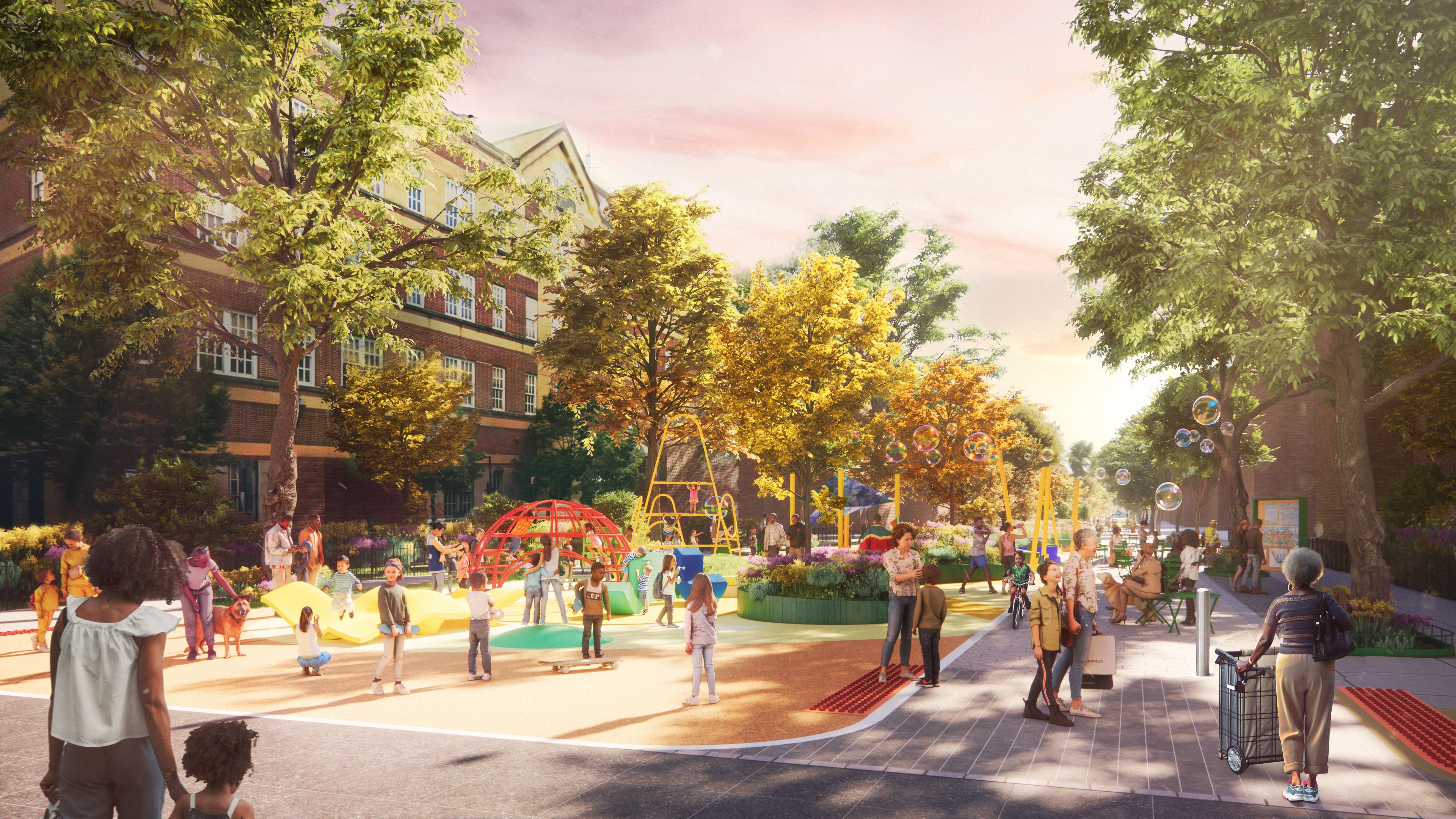
With the Paseo Park Alliance, we reimagined 26 blocks along 34th Avenue in Jackson Heights as a linear open space supporting safe routes to school, recreation, and everyday community life.
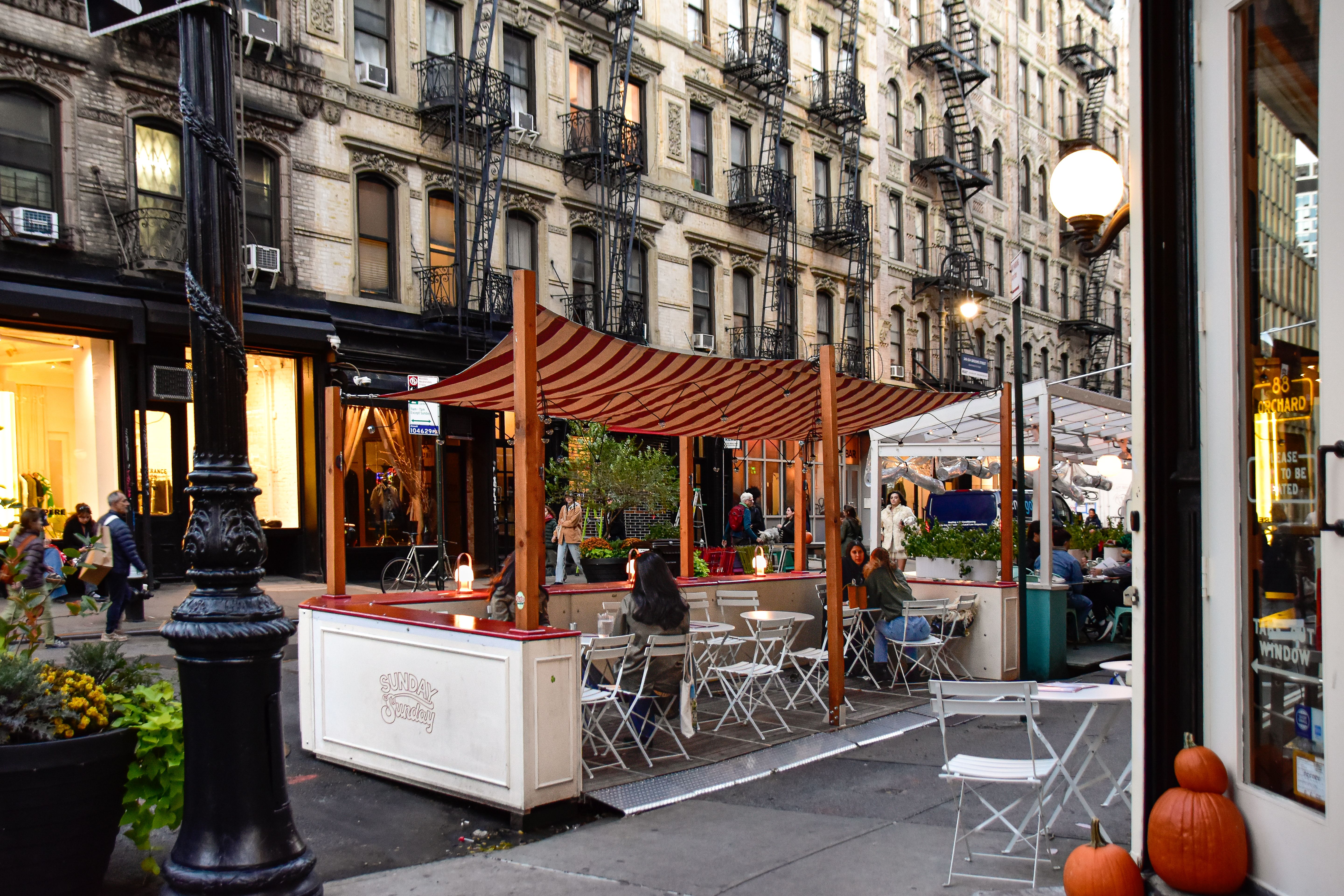
For NYC’s Dining Out program, we developed design elements that respond to real conditions, such as tight corners, slopes, and floating parking lanes, allowing streets to function as gathering places without sacrificing adaptability. With Open Dining set to evolve, the prototypes offer valuable lessons on durability and flexibility, and how city streets can better support and welcome year-round public life.
 Realized example of the Dining Out NYC plan, designed by WXY in collaboration with SITU and the NYC DOT. Photo by NYC DOT.
This way of looking at streets differently extends to larger, more complex infrastructures. Through the BQE Corridor Vision, a collaboration with the New York City Department of Transportation, we worked across more than ten miles of neighborhoods shaped by the expressway.
While the triple cantilever often draws public attention, the planning effort was grounded in sustained engagement with communities along the entire corridor. Residents, businesses, and local organizations helped define what reconnection could mean in their specific context, whether through capping segments of the highway, creating new parks, redesigning adjacent streets, or stitching together fragmented greenways.
 Rendering of the southern part of the BQE, showing a capped section and public realm interventions, by WXY.
Transforming streets into places for movement, rest, and connection expands the public realm without acquiring new land. These conversions improve safety, strengthen greenways, support small businesses, and bring open space to communities that need it most.
5. Support community stewardship of NYC’s natural environment
New York’s natural environment performs critical infrastructure functions. But too often, the planning and funding of these spaces are an afterthought.
The city’s urban canopy covers nearly a quarter of its land area, managing stormwater, improving air quality, and cooling neighborhoods. Natural shorelines buffer communities from storms while providing access to recreation and the waterfront. These systems depend on consistent care, yet maintenance and investment are rarely aligned with community capacity or opportunity.
 RISE Volunteers working on dune restoration in the Rockaways, Queens, NY. Photo by Giles Ashford.
What stewardship delivers
Our work on New York City’s first Urban Forest Plan, currently underway, will help center workforce development and community-led maintenance, expanding who participates in caring for the urban canopy. In the Rockaways, we partnered with RISE and eDesign Dynamics through the Rockaway Dune Enhancement Plan to transform vulnerable shoreline into living infrastructure shaped by local hands, supporting resilience, education, and ecological stewardship.
When communities are supported as stewards, natural systems perform better and last longer. Stewardship strengthens social ties, builds skills, creates paid green jobs, and ties environmental investment directly to quality of life.
Stewardship of green infrastructure isn’t peripheral to urban planning; it sits at its core.
Looking ahead, we see work focused on deepening agendas that matter. The priorities above reflect where planning can deliver the greatest impact, quickly and equitably, across neighborhoods and systems. The coming year offers a chance to translate experience into actions that can improve the lives of every New Yorker.
Claire Weisz Architects LLP
d/b/a WXY architecture + urban design
212 219 1953
office@wxystudio.com
Careers ↗
New York
25 Park Place, 5th Floor
New York, NY 10007
Toronto
30 St. Patrick Street, 5th Floor
Toronto, ON M5T 3A3 Canada
Subscribe to our newsletter
Site designed by Clinton Van Arnam
Developed by Mario Giampieri